Share the page
ENGULF Program: Assessing exposure to relative sea-level rise along the Gulf of Guinea

-
Project start date
-
2022Status
Ongoing
-
Project end date
-
2026
-
Project duration
-
4 years
-
AFD financing amount
-
200000
-
Country and region
-
Partners
-
French National Research Institute for Sustainable Development (IRD), Virginia Tech (United States), University School for Advanced Studies in Pavia (Italy), University of Wageningen (Netherlands), University of Padova (Italy), University of Lagos (Nigeria), Cheikh Anta Diop University (Senegal), University of Ghana
-
Research program
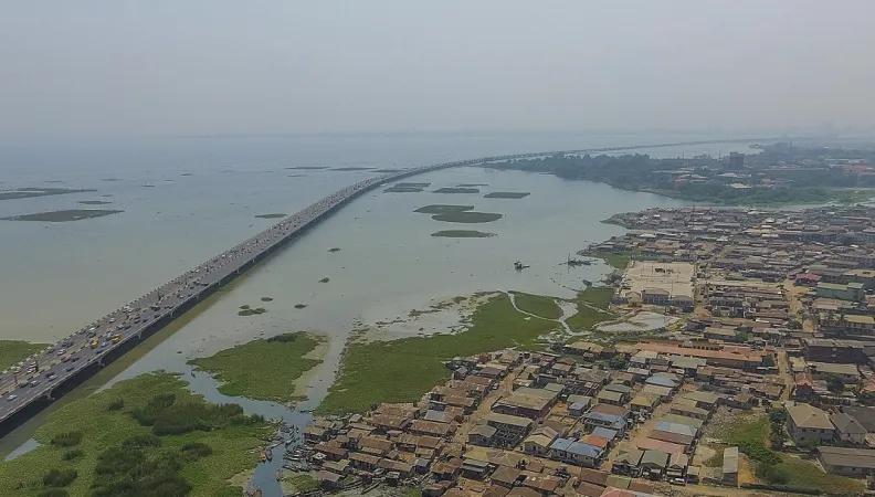
The coastline of the Gulf of Guinea is lowly elevated and particularly vulnerable to sea level rise triggered by climate change. However, in some places, another important factor has to be taken into account to correctly assess the exposure of inhabitants and ecosystems: the gradual lowering of the land surface. The objective of this research program is to quantify this phenomenon and to understand drivers and processes, especially in coastal megacities and deltas.
Context
The densely populated and lowly elevated coastline of the Gulf of Guina is particularly exposed to coastal erosion and sea-level rise. The entire coastline is currently experiencing alarming erosion rates, ranging from 1 to 15 meter per year between Côte d’Ivoire and Nigeria, mostly because of human activities. The problem is well studied and various programs aim to put in place coastal protection measures. By contrast mid- and long-term vulnerability to sea-level rise triggered by climate change has received less attention in this region.
In addition, to assess the various risks induced by sea-level rise, it is also necessary to consider land surface movements. The gradual lowering of the land surface in some places is called subsidence. The phenomenon is widespread at the global scale, especially in coastal megacities and deltas: 51 to 71% of present-day relative sea-level rise experienced by people worldwide is actually caused by subsidence. The rate can reach several centimeters per year in some places, however coastal subsidence is globally critically under-quantified, and the Gulf of Guinea region is no exception to this.
Objectives
This research program aims to fill the lacune in knowledge on coastal land subsidence and relative sea-level rise along the Gulf of Guinea. It will provide useful space-borne quantifications of current coastal subsidence rates, assess the driving forces of land subsidence and provide first projections of potential future subsidence using numerical models.
Impact will further be created by collaborating with local institutes, connecting to other projects and disseminating findings, data and tools to local stakeholders.
One of the long-term objectives is also to create awareness and agenda setting of this issue of relative sea-level rise in the region, in order to support sustainable development or adaptation projects in coastal areas and policymaking in the region.
Method
The first working group will assess current subsidence rates for the whole coastline, using satellite data to monitor vertical land movement over several years. The results will be combined to satellite elevation data to provide a first assessment of the areas that could be flooded in future decades.
The second working group will focus on the city of Lagos and surroundings, to provide an in-depth analysis of subsidence and to understand drivers and processes. The research team will build a process-based numerical model of subsidence to provide projections of future subsidence rates according to different scenarios.
Then, the methods developed for Lagos will also be applied to 3 or 4 other areas, coastal megacities or deltas, identified as “hotspots” for relative sea-level rise by the first working group.
Knowledge exchange events (seminars and workshops) will also be regularly organized, to disseminate research findings and build a regional community of interest on subsidence and relative sea-level rise.
Results
Results will be shared through scientific papers, technical reports, on-line databases and policy briefs. They will provide valuable information for policymakers and coastal (infrastructural) development projects potentially impacted by relative sea-level rise. In particular, results will help to better calibrate coastal adaptation measures and may also identify areas where the efficiency of natural coastal defences could fail in the future. Understanding the drivers of subsidence will also help to identify potential mitigation measures. The project will also foster public policy dialogue on coastal vulnerability, to favor adaptation projects.
In November 2023, a Research Conversations webinar provided an overview of the current state of knowledge on these issues in the region. The replay is available below:
The ENGULF project team then organized a webinar series to present the main findings of the ENGULF project. The replays are available below.
- Session 1: "Sinking Shores, Rising Concerns: Coastal Land Subsidence and its Implications for the Future of Ghana's Volta Delta" (April 4, 2024). Prof. Kwasi Appeaning Addo and Dr. Selasi Yao Avornyo presented their research work carried out at the University of Ghana.
- Session 2: "Insights into Increasing Land Subsidence along Nigeria's Gulf Coast" (May 2, 2024). Dr. Femi Ikuemonisan presented his research work carried out at the Lagos State University of Education (Lagos, Nigeria).
- Session 3: "Unraveling Gulf of Guinea's land subsidence dynamics using InSAR post-processing insights". Dr. Roberta Boni presented her research work carried outa at the University School for Advanced Studies IUSS Pavia (Italy).
A West African international workshop, organised in November 2024 in Ghana, focused on the challenges of coastal land subsidence. The summary video is available by clicking here.
Download the final report
- Comment évaluer les risques d'inondation dans les zones côtières de basse altitude où on manque de données ? La précision des données sur l'élévation est déterminante (April 2024)
- A scoping study on coastal vulnerability to relative sea-level rise in the Gulf of Guinea: Coastal elevation and literature review (June 2023)
- A scoping review of the vulnerability of Nigeria's coastland to sea-level rise and the contribution of land subsidence (June 2023)
- Vulnerability of Ghana's coast to relative sea-level rise: A scoping review (June 2023)
- A scoping review of coastal vulnerability, subsidence and sea level rise in Ghana: Assessments, knowledge gaps and management implications (Quaternary Science Advances, October 2023)
- The contribution of coastal land subsidence to potential sea-level rise impact in data-sparse settings: The case of Ghana’s Volta delta (Quaternary Science Advances, June 2024).
- ENGULF: Coastal land subsidENce in the GULF of Guinea – The case of Dakar and Cape Verde Peninsula (Senegal): Vertical land motion, its relations to hydrogeology and land use and implications for relative sea-level rise and flood exposure. (ENGULF, 2025)
Would you like to stay updated on research at AFD?
Contact
-
Marie-Noëlle WOILLEZ
Research Officer


