 The degradation of nature can significantly impact a country's economic and social stability. Based on the case of South Africa, this study introduces a method to identify the economic sectors most vulnerable to risks stemming from biodiversity loss and assess their potential effects on various socio-economic indicators. Simultaneously, this method highlights sectors that present development opportunities due to a healthier biodiversity.
Context
Recent studies examining the risks to financial system stability associated with nature degradation have been conducted for countries such as the Netherlands, France, and others. These studies consistently underscore that biodiversity loss can have profound destabilising effects. Such effects may arise either from the collapse of ecosystems and the services they provide to economies (referred to as ‘physical shocks’) or from shifts in behaviour, technology, or regulation linked to ecological transitions (‘transition shocks’).
However, these risks extend well beyond the financial sector, particularly in countries from the Global South. How can the macro-financial context be better incorporated into analyses of nature-related risks in emerging economies, where it plays a critical role in the resilience of businesses and institutions? And in the context of climate challenges, how can we better account for the territorial dimension of nature-related risks and conduct spatially explicit assessments?
Objectives
Focusing on the case of South Africa, this study evaluates the potential effects of either a physical shock (resulting from the degradation of ecosystem services) or a transition shock (arising from measures or innovations aimed at reducing the pressures certain economic sectors place on biodiversity). These effects will be examined across multiple dimensions, including production, income generation, inflation, employment, wages, external balance, and fiscal stability.
Beyond this broad analysis, the method seeks to identify the specific locations of these risks within the region. This spatially explicit approach aims to provide actionable insights for local decision-makers, enabling them to implement well-informed measures for an effective ecological transition.
Method
This study introduces innovative methods for assessing the socio-economic risks associated with nature degradation, grounded in two main contributions:
- Multidimensional analysis of macro-financial and social variables: the study examines the exposure of key macro-financial and social variables to nature-related risks. By using input-output tables extended to include environmental and socio-economic satellite accounts, it identifies how these risks could significantly affect sectors that are directly and indirectly critical to production chains and, consequently, socio-economic stability.
- Granular spatial assessment: at the municipal level in South Africa, the study investigates nature-related vulnerabilities through a more detailed spatial analysis. This approach integrates spatially disaggregated economic data with mapped ecological data to ensure consistency, enabling the identification of specific socio-economic exposures.
Together, these two interconnected approaches emphasize the need for a holistic understanding of nature-related risks. They demonstrate the value of interdisciplinary collaboration between economists and ecologists, aiming to balance the intertwined goals of economic prosperity, social stability, and environmental sustainability.
Research findings
The study identifies economic sectors potentially exposed to significant risks and provides South African stakeholders with a foundation for conducting deeper analyses to determine the extent and materiality of these risks.
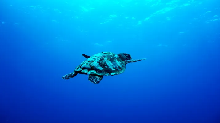
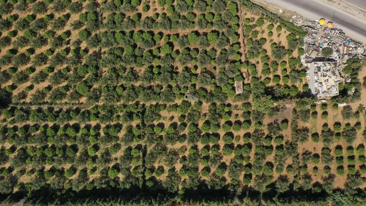
In South Africa, for instance, 80% of the country’s exports and 60% of business loans are heavily reliant on the water supply services provided by ecosystems. Beyond direct exposure, shocks affecting sectors dependent on these ecosystem services can cascade through the industrial network, triggering demand or supply disruptions. While 18% of jobs and 24% of salaries are directly exposed to such risks—particularly in the property and manufacturing sectors—these figures rise to 48% and 56%, respectively, when considering activities indirectly linked through value chains.
Given biodiversity’s strong dependence on geographic factors, it is essential to complement prior analyses with geolocalised studies. These analyses identify the economic activities located in areas where ecosystems and their services are already degraded. For example, when factoring in the location of companies involved in exports, the initial estimate that 80% of South African exports depend on surface water supply decreases to around 23%. This revised figure reflects exports generated by activities reliant on surface water supply and situated in municipalities where this ecosystem service is significantly degraded. In other words, when the geographic degradation of ecosystem services is considered, nearly a quarter of net exports are directly vulnerable to water scarcity.
Find out more:
- Read the research paper: Socio-economic and spatially-explicit assessment of nature-related risks – The case of South Africa
- Read the research paper: A framework to assess socioeconomic and spatialized nature-related risks: An application to South Africa (Environmental and Sustainability Indicators, 2025)
- Watch the replay of the Research Conversations webinar on the research project, with South African partners
Key outcomes
The method has garnered interest and validation from numerous economic and environmental policymakers, highlighting its relevance. Rather than focusing on precise numerical results, the emphasis lies on the orders of magnitude and the identification of economic sectors that are either highly dependent on ecosystem services (exposed to physical risks) or exert significant pressure on biodiversity (exposed to transition risks). These insights are sparking interest and debate.
One of the key outcomes has been fostering dialogue among South African stakeholders who previously had limited interaction, including the South African National Biodiversity Institute (SANBI), the Department of the Environment, the Department of Finance, and the South African Reserve Bank (SARB).
South African stakeholders are now working to translate these technical findings into accessible materials for non-specialist audiences and to facilitate deeper discussions with representatives from sectors identified as either risk-exposed or offering opportunities for resilience and positive socio-economic impacts.
Furthermore, the South African Reserve Bank, in collaboration with the Agence Française de Développement (AFD), is applying this method to assess the financial sector's exposure to nature-related risks across member countries of the Southern African Development Community (SADC). The Development Bank of South Africa (DBSA) has also begun using this approach to evaluate the exposure of its own portfolio. Future iterations and enhancements of the method are anticipated as its use expands.
Contacts
- Paul Hadji-Lazaro, Ecological Macroeconomist at AFD
- Julien Calas, Research Officer on Biodiversity, AFD
- Antoine Godin, Economist, Head of AFD Macroeconomic Modelling Unit
- Andrew Skowno, National Biodiversity Analysis Coordinator at SANBI
- Pamela Sekese, Geospatial Consultant
Discover other research projects


Exploring the dilemmas of Africa’s agroecological transition by 2050 (TAASF2050)
Ongoing
2022 - 2026
Stay up to date with our latest research news

 Can South Africa secure the necessary investments to transition to a low-carbon economy and adapt its infrastructure to climate change, while balancing economic growth and maintaining macro-financial stability? AFD is supporting South Africa in addressing climate change through the GEMMES South Africa project, developed with academic and institutional partners.
Context
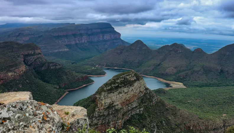
South Africa requires significant investment to transition to a low-carbon economy and resilient infrastructure, especially in energy and water sectors. Heavily reliant on coal and facing increasing water scarcity due to climate change, South Africa’s shift towards sustainability is crucial for long-term environmental and economic stability.
With the support of AFD, the University of Cape Town (UCT), Development Bank of Southern Africa (DBSA), Presidential Climate Commission (PCC), National Treasury, and the Centre for Sustainability Transitions of Stellenbosch University are developing a model that evaluates the macroeconomic impacts and various policy options and financing mechanisms for transitioning South Africa's water, energy, and food (WEF) systems in response to climate challenges.
This project falls under the “South Africa – Towards Inclusive Economic Development” (SA-TIED) initiative, a research and policy programme aimed at fostering inclusive economic growth in South Africa.
The GEMMES programme is developing a general theoretical model on the one hand, and national models applied to concrete cases and adapted to the characteristics of each country on the other, including the GEMMES South Africa model.
Objectives
The GEMMES South Africa project aims to:
- Analyze the macro-financial impacts of transitioning to renewable energy, ensuring water security, and maintaining food sustainability;
- Provide policymakers with insights and forecasts to inform decision-making and long-term planning for economic growth, employment, and climate resilience and more specifically provide insights into the macroeconomic effects of climate-resilient investments up to 2050;
- Enhance understanding of the vulnerabilities and opportunities in South Africa’s transition by integrating macro-financial feedback loops into structural change analysis;
- Foster sustainable development and mitigate environmental risks, contributing to long-term economic stability and improved quality of life;
- Promoting public policy dialogue on South Africa's low carbon transition.
Method
In addition to its specific transdisciplinary approach, which makes this project one of the few to integrate the notion of strong sustainability, the originality of GEMMES lies in its consideration of macro-financial imbalances and the impact of the low-carbon transition on all elements of the balance of payments.
GEMMES South Africa builds on UCT’s SATIM-GE energy transition model incorporating macro-financial feedback loops, which provide critical insights into the country's economic vulnerabilities and investment opportunities during this transition.
GEMMES South Africa is built in partnership with local authorities and research institutes to guarantee that the tool is coherent with the country's needs and to assure that the partners are capable of using and improving independently. It will account for:
- the dynamics of interest and exchange rates and their impact on private investment and employment;
- the fiscal and macro-financial constraints;
- different dynamics between banks and non-bank financial institutions;
- the capacity of public investments in green infrastructure to drive a new ecological transformation plan;
- and, the impacts of climate changes.
Expected results
The GEMMES South Africa project anticipates several key publications, including:
- A presentation of the specificities of GEMMES-South Africa and its baseline simulations;
- The macro-financial implications of infrastructures investments;
- The macro-financial implications of climate change impacts.
These papers will provide valuable insights into the project's findings and contribute to ongoing discussions in the field.
Research findings
At this stage, while the project is still in its early phases, it is expected that integrating macro-financial feedback loops will play a significant role in shaping effective policies and investment strategies. As the project progresses, ongoing stakeholder dialogue will be crucial in refining these concepts and addressing future challenges in the transition process.
Download the publications related to other South Africa modelling projects:
Want to stay updated on AFD’s latest research?

Contacts
-
Paul HADJI-LAZARO
Economist - Modeller

-
Antoine GODIN
Economist - Modeler

Discover other GEMMES projects

 Legal notice EU (project) What would be the impact of a carbon tax policy on poverty and inequality in Indonesia? How can we design effective policies that simultaneously meet environmental and distributive objectives? In partnership with LPEM, the EU-AFD Research Facility on Inequalities aims to adapt the CEQ Institute framework to understand the distributional impact of actual and potential carbon prices in Indonesia, as well as potential mitigation options.
Context
Indonesia’s commitment to carbon emission reduction is aligned with its global responsibilities under the Paris Agreement. The country is also one of the 52 national jurisdictions in the world that have established carbon pricing regulations (World Bank, 2023). The primary goal of carbon pricing instruments implementation is to support Indonesia in achieving its Nationally Determined Contribution – which are commitments that countries make to reduce their greenhouse gas emissions as part of climate change mitigation.
In this context, the Government of Indonesia intended to introduce carbon pricing instruments on a voluntary basis from 2021 to 2024, with a shift to mandatory enforcement expected by 2025. Despite its modest start, the introduction of this tax marks a considerable advancement in Indonesia, particularly given the few low and middle income countries that have implemented a carbon tax.
Using carbon pricing as a method to foster a decarbonised economy is a significant policy instrument, yet it can lead to uneven burdens across different societal groups. These measures, while environmentally beneficial, may inadvertently promote inequality. If these disparities are not addressed, the push towards global decarbonation could be hindered, achieving less impact or imposing uneven costs.
Using an analytical tool from Commitment to Equity Institute (CEQ Institute), this research project aims to improve the design of policies that can both deliver environmental goals whilst reducing the distribution burden, by ensuring a just transition.
This project is part of the Extension of the EU-AFD Research Facility on Inequalities. Coordinated by AFD and financed by the European Commission, the Extension of the Facility will contribute to the development of public policies aimed at reducing inequalities in four countries: South Africa, Mexico, Colombia and Indonesia over the period 2021-2025.
This research project complements two studies carried out by the EU-AFD Research Facility on Inequalities in collaboration with the Indonesian government on Marine Protected Areas development policies and the production of a diagnostic on inequalities in the country.
Objectives
The general objective of this research project is to assess the environmental (emission) and welfare-distributional effects (indicators of poverty and inequality) of trading and non-trading instruments (carbon price and revenue). Specifically, the study aims to incorporate heterogeneous cost and impact assessments across the archipelago of Indonesia.
The study will focus on the impact of carbon pricing and other indirect fiscal instruments (taxes and subsidies) combined with direct taxes and social transfers that can assist in the mitigation of these instruments on welfare distribution and environment.
Method
In order to design more effective policies that meet both environmental and distributive objectives, CEQ Institute has developed an analytical tool using micro data on household characteristics, behavioural science and a data analytical tool known as microsimulation modelling. It is an ex ante planning tool taking micro units, such as households, and simulating policy changes in advance of policy implementation.
The framework incorporates the following discrete analytical dimensions:
- Methodological frameworks to model the distributional impact of fuel related fiscal policies;
- An Input-Output framework to track the indirect impact of carbon prices;
- Behavioural implications of alternative environmental challenges using a demand system;
- Identifying just transition solutions using social protection instruments.
The dataset integrates two primary sources: the 2016 Table Input Output from the Central Bureau of Statistics (BPS) and the 2022 National Socioeconomic Survey (SUSENAS). Data and information from the Indonesian Directorate General of Taxes and from various relevant ministries are also used to conduct the study.
Research findings
The research paper related to this project is available for download here: Data Analytics for a Just Transition. Distributional Impacts of Environmental Policies (Indonesia)
The study concludes that the success of Indonesia’s energy transition will depend not only on its environmental effectiveness but also on its ability to ensure fairness across different segments of society.
For further information
Contact
-
Anda DAVID
Economist, scientific coordinator of the EU-AFD Facility on Inequalities

Other research projects supported by the Extension in Indonesia
Harnessing the benefits of inequalities reduction in marine protected areas in Indonesia
Completed
2022 - 2023